The 100,000th Mars Photo: Why NASA's Real Victory Isn't on the Red Planet

NASA's MRO hits 100k images. But the real story isn't Mars; it's the hidden battle for deep space dominance and Earth-based data infrastructure.
Key Takeaways
- •The 100,000 image milestone signals the success of persistent, high-bandwidth orbital infrastructure, not just photography.
- •The real winners are the terrestrial defense and data infrastructure firms benefiting from proven long-duration remote operations.
- •The focus on Mars exploration risks diverting attention and funding from more urgent Earth science missions.
- •Expect the next major deployment of this technology architecture to focus immediately on establishing a strategic lunar data network.
The Milestone We’re Supposed to Celebrate: A Data Deluge
NASA’s Mars Reconnaissance Orbiter (MRO) has officially captured its 100,000th image of the Red Planet. On the surface, this is a triumph of engineering and planetary science. For over a decade, the HiRISE camera has been beaming back breathtaking, high-resolution panoramas, fueling our obsession with **Mars exploration** and the search for ancient life. But let’s be brutally honest: celebrating 100,000 photos is like celebrating a hard drive filling up. The milestone isn't the *number*; it's the sheer, terrifying volume of data generated, and who is positioned to process and weaponize it. This achievement is a Trojan horse. The true story here is the maturation of persistent, high-bandwidth surveillance beyond Earth orbit. MRO is not just a camera; it’s a proof-of-concept for permanent extraterrestrial infrastructure. Every pixel transmitted back is a victory for the deep space data pipeline, a pipeline that will soon serve far more than just geology enthusiasts.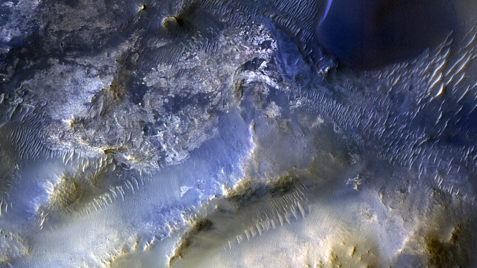
The Unspoken Truth: Who Really Wins?
The primary beneficiary of this data deluge is not the public, but the burgeoning **space economy** and the terrestrial defense contractors funding the next generation of orbital assets. While MRO feeds academic papers, its longevity proves the viability of long-term, autonomous operations far from Earth’s protective bubble. The winners are the companies—often the same ones building spy satellites—who are refining the compression algorithms, the autonomous navigation systems, and the ground station networks required to handle this persistent flow. The real competition isn't between rovers; it’s between nations and corporations securing orbital real estate and the intellectual property derived from analyzing this massive **planetary imaging** archive. Consider the loss: The hyper-focus on Mars exploration often distracts from critical, underfunded Earth science missions. We are spending billions to map ancient riverbeds on Mars while crucial climate data streams from Earth orbit are starved for resources and public attention. This is the hidden cost of the space race spectacle.The Deep Dive: From Science to Strategic Asset
Why does this matter beyond the dusty landscapes? Because MRO’s success normalizes the concept of high-resolution, persistent off-world observation. If you can monitor the subtle erosion patterns on Olympus Mons for ten years, you can monitor resource deposits on the Moon or track orbital debris with unprecedented precision. This isn't just science fiction; it’s the necessary precursor to sustained off-world operations, whether commercial or military. The data fidelity achieved by HiRISE sets the benchmark for every future planetary mission, solidifying the technological advantage of the agencies that mastered this process first. This is about establishing the **data sovereignty** of space.What Happens Next? The Lunar Data War
My prediction is that the immediate future of this technology will pivot away from Mars and toward the Moon. The Artemis program requires robust, reliable orbital assets for communication and reconnaissance around the Moon, especially as private ventures ramp up lunar landing attempts. We will see the direct evolution of MRO’s architecture—perhaps rebranded as the 'Lunar Reconnaissance Orbiter 2.0'—focused less on scientific discovery and more on mapping landing zones, resource prospecting (water ice), and establishing a near-Earth orbital data relay grid. The 100,000th image is just the warm-up act for the commercial and strategic land grab that is about to define the next decade of space policy. Expect significant governmental and private investment to shift toward lunar orbital infrastructure within the next three years, directly leveraging the operational lessons learned from the MRO era. This is the real payoff for NASA's long-term commitment.Image Credit: NASA/JPL-Caltech/University of Arizona
Frequently Asked Questions
What is the primary instrument responsible for these 100,000 images on the MRO?
The primary instrument is the High Resolution Imaging Science Experiment (HiRISE) camera, known for capturing images with resolutions as fine as 25 centimeters per pixel.
How does the MRO data volume impact future Mars missions?
The massive archive of MRO data is crucial for selecting safe and scientifically interesting landing sites for future missions like the Perseverance rover and upcoming sample return efforts. It reduces mission risk significantly.
Is the MRO still operational and what is its expected lifespan?
Yes, the MRO remains operational, far exceeding its original planned lifespan. While its future is not guaranteed indefinitely due to aging hardware, it is currently expected to continue operations for several more years, supporting upcoming missions.
What is the difference between MRO and the Viking orbiters in terms of imaging?
MRO, particularly via HiRISE, provides vastly superior resolution and spectral data compared to earlier orbiters like Viking. Viking provided foundational context; MRO provides actionable geological detail.
